Saturday, 3 September 2016

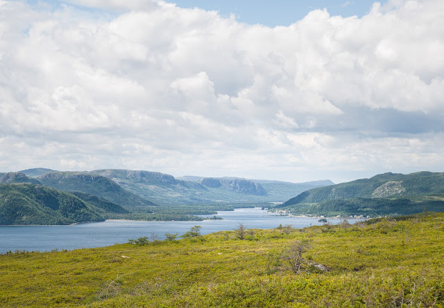
Southwest Brook Trail, Terra Nova National Park


It’s wonderful to see this lovely trail re-opened. In 2010 Hurricane Igor brought its 200 mm of rain and 100+ km/hr destructive wind power to this area resulting in the closure of this trail. I don’t know the full extent of the damage here, but it’s almost a certainty that most of the bridges and many of the boardwalks were wiped out.


Parks Canada has done a wonderful job of restoring the trail this year, making it a lovely walk and easy enough for children to enjoy.  Presumably, welcome changes in federal government spending priorities have allowed Parks Canada to undertake the necessary repairs this year. 


Most impressive is the new suspension bridge and the many sections of new boardwalk as the trail makes its way through areas that would be wet most times of the year.


A variety of wildflowers can be seen along the trail, Yellow Clintonia, Turtlehead, and the much maligned  Purple Loosestrife, which is highly invasive but still very pretty.


The trail follows Southwest Brook as it makes its way to the salt water of Southwest Arm. The brook is almost constantly in sight and sound with its tannic waters making cheerful music.  The trail meanders through coniferous forest where evidence of Hurricane Igor’s destruction can still be seen.


Since this is a National Park, berry picking is prohibited, but the ruby red Partridgeberries are plentiful. 

Partridgeberries, aka Lingonberries

The trail (about 2.7 km one way) comes out at the salt water of Southwest Arm where there is a picnic shelter. One could start the trail from here as well. The common route is to park beside the highway at the area near the picnic area about 6 km west of the Newman Sound turnoff. There is a picnic shelter and washrooms here as well. The trail starts near the brook by the Parks Canada sign.
 
Terra Nova National Park topographic map

Monday, 29 August 2016

Burgoyne's Cove RB-36 Crash Site


There are always some interesting walks that seem to linger on the "Someday" list. I had read about the unusual history behind the March 1953 American Air Force RB-36 airplane crash in a couple of places; Hike into History by: Susan Flanagan The Telegram Nov. 5, 2008 (link)  and summarized on the blog Hidden Newfoundland. 
 "On the night of March 17, 1953 General Richard E. Ellsworth and his crew took off from the Canary Islands on a mission to test North American air defenses. The mission took a tragic turn when a change in weather conditions pushed the plane off course. Early in the morning on March 18 the enormous B-36 Peacemaker aircraft crashed into a mountain on the western side of Trinity Bay just north of the community of Burgoynes Cove. All 23 crew members were killed."


I knew it wasn't an especially difficult hike, but as the saying goes: "Procrastination always gives you something to look forward to." The hike up to the RB-36 crash site near Burgoyne's Cove is definitely worth doing.

Driving to the trail head is not difficult, but be warned that the last 5km is gravel road that near the end can be rough but quite passable if you drive slowly.

map Burgoyne's Cove crash site Newfoundland
From Clarenville, travel through George's Brook to Rte 232 and follow it to Burgoyne's Cove (click to enlarge map)

As you pass a long and narrow pond area on the right side, (see map below), watch for eagles who sometimes nest in this area. This pond drains into Nut Cove below and at this point you are very close to the trail head.


detail map Burgoyne's Cove crash site Newfoundland
In Burgoyne's Cove, turn left past the church and then right at the Slate Quarry sign. Follow this gravel road about 5 km to the sign indicating the trail head (click to enlarge map).

The trail is well-defined and courses over red slate rocks up the hill through lovely forest.  There are a couple of benches along the way to relax and enjoy the mossy forest views. This trail is a steady climb for about 40 minutes, but it isn't overly strenuous if you take your time and enjoy the walk.

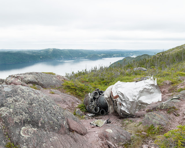
When you emerge from the forest, airplane debris is immediately visible, as is the superb view of Smith Sound, with Random Island, Lance Cove and Petley in the distance.


B-36 Crash Site Burgoyne's Cove overlooking Smith Sound
Looking at Smith Sound with Random Island, Lance Cove and Petley

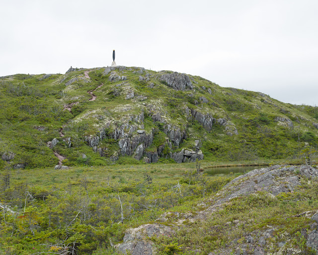
There is a further hill with a trail that leads to the monument erected in honour of the crew. It's worth making the final climb to the monument; you are rewarded with a 360 degree view of the area.

 
B-36 Crash Site Monument Burgoyne's Cove Newfoundland


At the hill top there is a monument dedicated to the B-36 crew members and listing their names. The monument features one blade of the airplane's propeller, giving one a sense of the size of this very large aircraft.

Propeller from B-36 with view of Smith Sound


 Coming back down the hill the main debris field can be seen in a small valley.
 
B-36 debris field

Tuesday, 23 August 2016

Another Louil Hill

The Louil Hills Trail in Terra Nova National Park is a popular hike that features a side trail of stairs leading to a hilltop that provides spectacular views of the park and surrounding land. This area also has the Malady Head trail which can be a moderately stiff climb to a sensational lookout point.

This summer, the Park staff have created a new, short trail that goes to the top of one of the Louil Hills  which also rewards the viewer with surrounding scenes of land and water, including views of Traytown, Culls Harbour and, in the distance, Glovertown.

Terra Nova National Park overlooking Traytown, Culls Harbour, Glovertown
Traytown, Culls Harbour and, in the distance, Glovertown.

The trail is neither long nor difficult, although some sections of bare rock could be tricky in wet weather. It's a straight, well marked path that takes about 20 minutes each way and there are very sturdy stairs constructed for the last section to the hill top.

Access from the Trans Canada Highway to the road that leads to Eastport, commonly known as "Road to the Beaches". There are two turnoffs to Traytown on this road and the trail access is between these two, on the left side as your go toward Eastport but before you reach Malady Head campground.


Thursday, 11 August 2016

Garden Cove Trails


Garden Cove trails are not often listed in searches for Newfoundland hiking but they are well worth  the short drive down the Burin Peninsula.

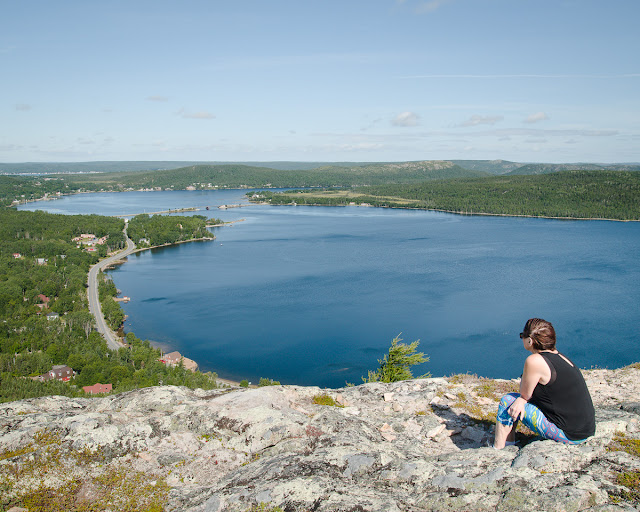
View from Big Rock Hill Garden Cove Newfoundland


map Garden Cove, Goobies, Clarenville, Trans Canada Highway Newfoundland

Directions:   Turn down the Burin Peninsula on Hwy 210 at Goobies. The second available left turn will take you to Garden Cove. At Garden Cove bear left and you will see a sign for Trail Parking at the end of the street.


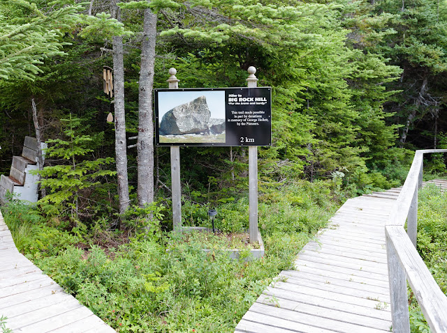
The trail is very well maintained, with many sections of board walk. A short ways down there is a sign indicating a side trail on the left to Big Rock Hill. Like the sign says, "For the brave and hardy". This trail starts off with a very steep climb then travels through woods and along boggy sections until it makes a final climb to the top of Big Rock Hill. 


Garden Cove Trail Newfoundland

There are sections of board walk but the trail can be a bit wet in places, especially after a rain.  This is prime habitat for Pitcher Plants, the official provincial flower; Bakeapples and Blueberries can also be seen and picked in late summer or early autumn.


Pitcher Plant Sarracenia purperea


Big Rock Hill Garden Cove Newfoundland
The big rock, probably an erratic moved here by glaciers, is in several pieces now but it is an impressive sight at the top of this hill.


View of Swift Current Newfoundland from Garden Cove Big Rock Hill
There are many fine views of the surrounding land and sea. Looking west you can see Swift Current and the surrounding rock formations, including Bear's Folly.


After returning to the main trail, it's only a short walk to a shelter built by the water. Inside there is a wooden box containing binoculars and four guest books.


From here there is one more short side trail to Placentiaman's Point, a lovely quiet spot by the water that would be perfect for a relaxing lunch.